
Signing & Pavement Marking
Complete signing and pavement marking plan sets for highways, arterials, intersections, and bicycle facilities.
Signing and Pavement Marking
The AMD Engineering team uses Geographic Information Systems (GIS) layers or detailed survey (where available) to create existing conditions base plans for the project limits. The base plans are populated utilizing Google Earth prior to conducting a field review to verify that existing surface features and geometric features are accurate as shown on the drawings. Each field review includes a photographic and tape-and-wheel inventory of all features relevant to the design including existing lane widths and pavement markings, signing, crosswalks, parking, bus stops, location and condition of curb ramps, driveway entrances, divider islands, and medians.
AMD Engineering prepares complete signing and pavement marking plan sets in accordance with the Manual on Uniform Traffic Control Devices (MUTCD), the applicable state supplement, and agency standards such as the VDOT Road and Bridge Standards and Traffic Engineering Design Manual. A typical plan set includes:
A Typical Plan Set Includes
- General notes, legend and tabulations: project-specific notes, symbol and line-type legends, and summary tables of signs, supports and pavement marking quantities
- Signing plans: the location, station and offset of every proposed sign, along with existing signs to remain, relocate or remove, drawn over the existing conditions base
- Sign panel details: sign dimensions, legend, letter height and font series, route shields, arrows, sheeting type and fabrication details. Overhead guide sign panels are laid out in GuideSign to confirm sizing and legibility.
- Sign supports and structures: support types for ground-mounted signs (such as square tube, U-channel and breakaway supports), plus the location and type of overhead structures (cantilever, span and bridge-mounted). Structure locations are coordinated with structural, lighting, ITS and utility designers.
- Pavement marking plans: lane lines, edge lines, gore and lane-drop markings, stop bars, crosswalks, arrows, words and symbols, with line width, color, pattern, material (such as thermoplastic, epoxy, paint or preformed tape) and limits clearly defined
- Raised pavement markers and eradication: snowplowable raised pavement markers where required, and removal of existing markings that conflict with the new design
- Quantities, specifications and estimates: bid item quantities, special provisions where needed, and an engineer's estimate of construction cost
On design-build projects, plans are developed in phased submittals and carried through agency review and comment resolution. On the $361.6 million I-81 Widening CIP, that work ran through VDOT ProjectWise.
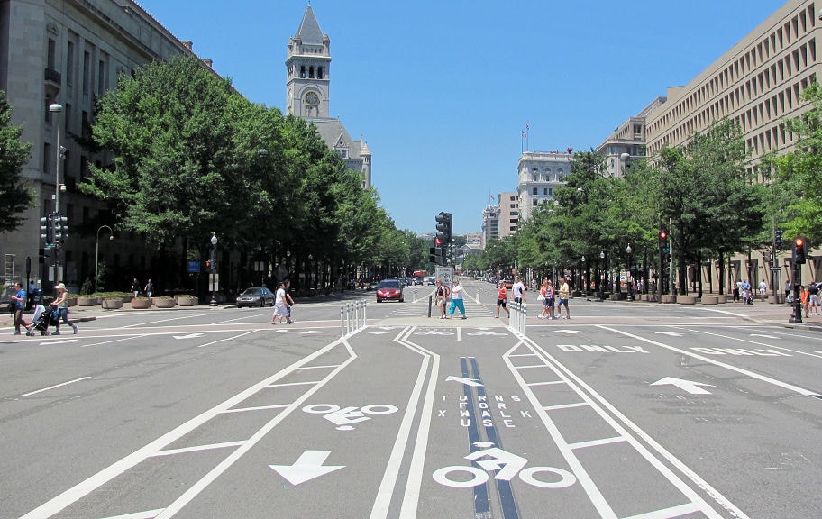
AMD Engineering also designs bicycle facilities, including cycle tracks, bike lanes and shared lane markings, per MUTCD, AASHTO and NACTO guidance.
Project History
- I-81 Widening CIP Signing and Pavement Marking
- VDOT Richmond District On-Call
- Virginia MegaProjects GEC*
- Capitol Crossing (I-395 Air Rights), Washington, DC*
- DDOT New Jersey Avenue Two-Way Conversion*
- I-581/Valley View Diverging Diamond Interchange*
- I-95 Bridge Replacement over the Meherrin River*
- Fairfax County On-Call Design Services*
- City of Alexandria On-Call Design Services*
- DDOT Bicycle Design On-Call*
* Projects managed and/or designed by principals while at previous firms
Ready to start your project?
Contact Us